Wisconsin Regional Orthoimagery Consortium (WROC)

The Wisconsin Regional Orthoimagery Consortium (WROC) is a multi-entity group. The goal of the consortium is to build and sustain a multi-participant program to acquire digital orthoimagery and elevation data throughout Wisconsin. The WROC approach brings a number of potential benefits to participants including cost savings, specifications and standards support, customized datasets, data sharing between members and partners, and procurement support.

Next round

The next round of WROC is underway. North Central Wisconsin Regional Planning Commission (NCWRPC) will once again coordinate and lead the Consortium. In 2021, the RPC extended its agreement with Ayres Associates to facilitate the Consortium and provide geospatial services to its members and partners.

There will be options for participation in 2023, 2024, and 2025. A number of member counties will be going to a 3-year cycle starting in 2023. Another group of counties will fly in 2024.The largest group will participate again in 2025, keeping the consistency of the 5-year cycle. Member counties flying in 2023, 2024, and 2025 will be eligible for partner funding.

The aerial mapping services provided under WROC will continue to evolve to meet the needs of local government members and partner organizations. This will be achieved through a coordinated, county-by-county approach over the next three years, with participation peaking in 2025. Program representatives will work with all private, federal, and state partners to build the program into regional datasets. WROC has a stated goal of achieving statewide coverage by the end of 2025.

WROC representatives will be hosting meetings across the state to discuss the consortium approach and participation options for 2023-25. If you are interested in meeting, please contact program managers Andy Faust or Zach Nienow

Wood County
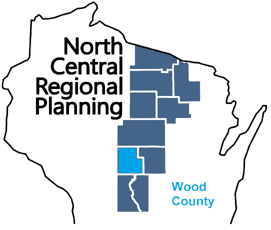
Wood County is a county located in central Wisconsin. As of the 2020 census, the population was 74,207. The county seat is Wisconsin Rapids. Wood County was created in 1856 and is named after Joseph Wood, who was a Wisconsin State Assemblyman. The county is known for its many lakes, rivers and outdoor recreational opportunities, including the Wood County Parks, the Wisconsin River and the Ice Age Trail. The county is home to the city of Wisconsin Rapids, which is the county’s largest city and the regional center for commerce, industry, healthcare, and education. The county also has several small towns and communities, including Marshfield, Nekoosa, and Port Edwards. The county has a diverse economy, with healthcare, manufacturing and service industries being the main drivers. The county is also known for its paper mills, which have been a staple industry in the area for many years.

TitleDate
Wood County Comprehensive Plan and Housing Study 2024September 6, 2024
Town of Port Edwards Comprehensive Plan 2024July 18, 2024
EMSI Reports – Economy OverviewJuly 17, 2024
Wisconsin Rapids Safe Routes To School – 2024April 3, 2024
Wood County Broadband PlanMarch 8, 2024
Town of Saratoga Comprehensive Plan 2023March 6, 2024
Wood County Economic Profile 2024January 22, 2024
Wood County Bicycle and Pedestrian Plan 2023October 18, 2023
Town of Saratoga Outdoor Recreation Plan 2023-2027March 15, 2023
Town of Seneca Comprehensive Plan 2022May 1, 2022
Town of Sigel Comprehensive Plan 2022February 2, 2022
Wood County Economic Profile 2022January 1, 2022
City of Pittsville Outdoor Recreation Plan 2022-2026November 1, 2021
Nekoosa Safe Routes to School PlanJuly 1, 2020
Wood County Locally Developed, Coordinated Public Transit-Human Service Transportation Plan 2019-2023August 31, 2018
Wood County Locally Developed, Coordinated Public Transit-Human Service Transportation Plan 2014-2018August 27, 2013
City of Nekoosa Comprehensive Plan 2012December 11, 2012
City of Wisconsin Rapids Outdoor Recreation Plan 2012-2016January 1, 2012
Marshfield Sewer Service Area Plan Update – 2030January 1, 2011
Grand Rapids/Saratoga Community Wildfire Protection Plan 2010July 13, 2010
Wisconsin Rapids Safe Routes to School Plan – 2010June 1, 2010
City of Wisconsin Rapids Comprehensive Plan 2010January 1, 2010

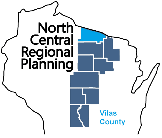
Vilas County

Vilas County is a county located in northern Wisconsin. As of the 2020 census, the population was 23,047. The county seat is Eagle River. Vilas County was created in 1893 and is named after William Freeman Vilas, who was a U.S. Senator from Wisconsin. The county is known for its many lakes, forests, and outdoor recreational opportunities, including the Vilas County Parks, the Eagle River Chain of Lakes and the Nicolet National Forest. The county is home to the city of Eagle River, which is the county’s largest city and the regional center for tourism and recreation. The county also has several small towns and communities, including St Germain, Conover, and Boulder Junction. The county has a strong tourism industry, with many visitors coming to the county for fishing, hunting, boating and snowmobiling.

TitleDate
Vilas County All Hazards Mitigation Plan Update 2024August 27, 2024
EMSI Reports – Economy OverviewJuly 17, 2024
Vilas County Land and Water Resource Management, 2025July 10, 2024
Vilas County Economic Profile 2024January 22, 2024
Vilas County Comprehensive Plan 2023November 14, 2023
Town of Plum Lake Comprehensive Plan 2023July 6, 2023
Vilas County Outdoor Recreation Plan 2023-2027April 5, 2023
Town of Conover Comprehensive Plan 2022February 10, 2022
Vilas County Economic Profile 2022January 1, 2022
Grow North Region Housing Study – 2021December 29, 2021
Town of Presque Isle Comprehensive Plan 2021September 1, 2021
Lac du Flambeau School District Safe Routes To SchoolJuly 19, 2021
Town of St. Germain Comprehensive Plan 2021March 25, 2021
Town of Winchester Comprehensive Plan 2021March 22, 2021
Town of Land O’ Lakes Comprehensive Plan 2020November 18, 2020
Town of Phelps Comprehensive Plan 2019November 19, 2019
Town of Washington Comprehensive Plan 2019November 4, 2019
Vilas County All Hazards Mitigation Plan Update 2019February 26, 2019
Vilas County Outdoor Recreation Plan 2019-2023January 1, 2019
Oneida-Vilas County Locally Developed, Coordinated Public Transit-Human Service Transportation Plan 2019-2023August 31, 2018
Lac du Flambeau Workforce Training & Business Development Center Feasibility StudyOctober 1, 2017
Vilas County Farmland Preservation Plan 2015February 1, 2015
Vilas County Land and Water Resource Management 2015-2024October 1, 2014
Northwoods NiiJii Enterprise Community, Inc. Comprehensive Strategic Plan – 2014January 1, 2014
Vilas County Outdoor Recreation Plan 2014-2019January 1, 2014
Forest, Oneida, Vilas County Locally Developed, Coordinated Public Transit-Human Service Transportation Plan 2014-2018August 7, 2013
Vilas County All Hazards Mitigation Plan 2013May 28, 2013
Vilas County Bicycle and Pedestrian Plan 2011September 1, 2011
Town of Cloverland Comprehensive Plan 2011July 25, 2011
Town of Phelps Comprehensive Plan 2010June 9, 2010
Town of Arbor Vitae Comprehensive Plan 2010May 1, 2010
Town of Land O’ Lakes Comprehensive Plan 2010January 1, 2010
Town of Conover Comprehensive Plan 2010January 1, 2010

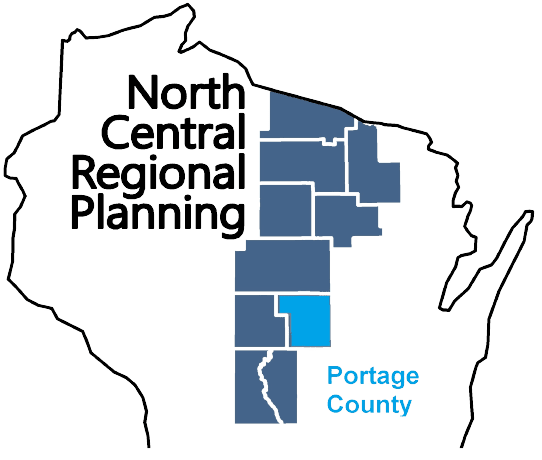
Portage County

Portage County is a county located in central Wisconsin. As of the 2020 census, the population was 70,377. The county seat is Stevens Point. Portage County was created in 1839 and is named after the Fox-Wisconsin Waterway, a historic portage route used by Native Americans and European settlers. The county is known for its many lakes, rivers, and outdoor recreational opportunities, including the Tomorrow River State Trail, the Wisconsin River and the Ice Age Trail. The county is home to the city of Stevens Point, which is the county’s largest city and the regional center for commerce, industry, healthcare, and education. The county also has several small towns and communities, including Plover, Rosholt, and Amherst. The county has a diverse economy, with healthcare, manufacturing, and service industries being the main drivers.

TitleDate
Portage County Comprehensive Plan 2024August 14, 2024
EMSI Reports – Economy OverviewJuly 17, 2024
Portage County Outdoor Recreation Plan 2025-2029April 2, 2024
Portage County Broadband PlanFebruary 27, 2024
Portage County Economic Profile 2024January 22, 2024
Stevens Point Urban Area Sewer Service Area Plan 2040 UpdateJuly 13, 2023
Portage County Economic Profile 2022January 1, 2022
Portage County Locally Developed, Coordinated Public Transit-Human Service Transportation Plan 2019-2023August 31, 2018
Portage County Locally Developed, Coordinated Public Transit-Human Service Transportation Plan 2014-2018July 11, 2013
Almond-Bancroft Safe Routes to School Plan 2012-2017April 1, 2012

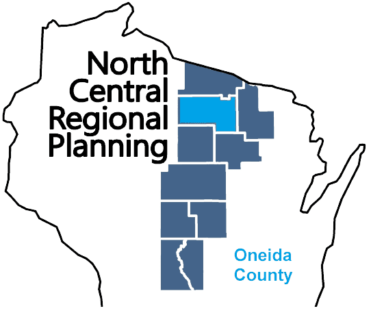
Oneida County

Oneida County is a county located in northern Wisconsin. As of the 2020 census, the population was 37,845. The county seat is Rhinelander. Oneida County was created in 1887 and is named after the Oneida Nation, which is a tribe of the Iroquois Confederacy. The county is known for its many lakes, forests, and outdoor recreational opportunities, including the Oneida County Forest, the Wisconsin River and the Nicolet National Forest. The county is home to the city of Rhinelander, which is the county’s largest city and the regional center for commerce, industry, healthcare, and education. The county also has several small towns and communities, including Three Lakes, Minocqua, and Hazelhurst. The county has a diverse economy, with tourism, manufacturing, and service industries being the main drivers.

TitleDate
EMSI Reports – Economy OverviewJuly 17, 2024
Oneida County Comprehensive Plan 2024June 17, 2024
Rhinelander Safe Routes To School – 2024April 3, 2024
Town of Crescent Comprehensive Plan 2024March 6, 2024
Oneida County Economic Profile 2024January 22, 2024
Oneida County Outdoor Recreation Plan 2024-2028October 2, 2023
City of Rhinelander Outdoor Recreation Plan 2023-2027March 15, 2023
Oneida County All Hazards Mitigation Plan Update 2023February 21, 2023
Town of Stella Comprehensive Plan 2022December 13, 2022
Town of Cassian Comprehensive Plan 2022June 13, 2022
Town of Monico Comprehensive Plan 2022April 4, 2022
Town of Newbold Comprehensive Plan 2021January 13, 2022
Oneida County Online Mapping RecordsJanuary 1, 2022
Oneida County Economic Profile 2022January 1, 2022
Grow North Region Housing Study – 2021December 29, 2021
Town of Pelican Comprehensive Plan 2019November 11, 2019
City of Rhinelander Bicycle and Pedestrian Plan 2019October 14, 2019
Minocqua J1 Safe Routes to School PlanAugust 1, 2019
Oneida County Land and Water Resource Management 2020-2029August 1, 2019
Oneida County Outdoor Recreation Plan 2019-2023December 1, 2018
Oneida-Vilas County Locally Developed, Coordinated Public Transit-Human Service Transportation Plan 2019-2023August 31, 2018
Town of Hazelhurst Comprehensive Plan 2017December 1, 2017
City of Rhinelander Comprehensive Plan 2016November 1, 2016
Oneida County All Hazards Mitigation Plan Update 2016September 20, 2016
Oneida County Farmland Preservation Plan 2015December 1, 2015
City of Rhinelander Outdoor Recreation Plan 2015-2020September 1, 2015
Oneida County Outdoor Recreation Plan 2014-2018May 1, 2014
Town of Lake Tomahawk, Road Surface Management Plan – 2014January 1, 2014
Northwoods NiiJii Enterprise Community, Inc. Comprehensive Strategic Plan – 2014January 1, 2014
Town of Cassian Traffic Count Report – 2013August 20, 2013
Oneida County Comprehensive Plan 2013August 20, 2013
Forest, Oneida, Vilas County Locally Developed, Coordinated Public Transit-Human Service Transportation Plan 2014-2018August 7, 2013
Rhinelander Safe Routes to School Plan – 2012-2017May 23, 2012
Oneida County Land and Water Resource Management 2012-2016December 6, 2011
Town of Cassian Traffic Count Report – 2011July 19, 2011
Oneida County All Hazards Mitigation Plan Update 2010September 21, 2010
Town of Woodruff Comprehensive Plan 2010September 16, 2010
Town of Cassian Traffic Count Report – 2010August 6, 2010
Town of Minocqua Comprehensive Plan 2010July 20, 2010
Town of Monico Comprehensive Plan 2010January 1, 2010
Town of Woodboro Comprehensive Plan 2009April 14, 2009

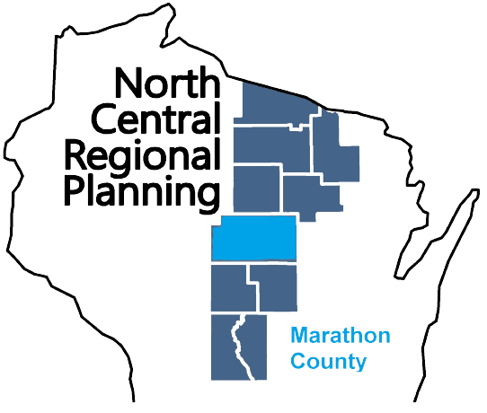
Marathon County

Marathon County is a county located in central Wisconsin. As of the 2020 census, the population was 138,013. The county seat is Wausau. Marathon County was created in 1850 and is named after the Marathon race of ancient Greece. The county is known for its many lakes, rivers, and outdoor recreational opportunities, including the Marathon County Parks, the Eau Claire River, and the Ice Age Trail. The county is home to the city of Wausau, which is the county’s largest city and the regional center for commerce, industry, healthcare, and education. The county also has several small towns and communities, including Mosinee, Rothschild, and Edgar. The county has a diverse economy, with healthcare, manufacturing, and service industries being the main drivers.

TitleDate
Town of Rietbrock Comprehensive Plan 2024July 19, 2024
EMSI Reports – Economy OverviewJuly 17, 2024
Wausau Safe Routes To SchoolMay 2, 2024
Athens Elementary Safe Routes To SchoolApril 3, 2024
Marathon Area Elementary Safe Routes To SchoolApril 3, 2024
Spencer Safe Routes To SchoolFebruary 26, 2024
Weston Elementary Safe Routes To SchoolFebruary 23, 2024
Marathon County Economic Profile 2024January 22, 2024
Marathon County Locally Developed, Coordinated Public Transit-Human Service Transportation Plan 2024-2028November 14, 2023
Marathon County All Hazards Mitigation Plan Update 2022October 25, 2022
City of Schofield Comprehensive Plan 2022August 16, 2022
Wausau Metropolitan Area Regional Housing AssessmentJuly 5, 2022
Town of Eau Pleine Comprehensive Plan 2022June 14, 2022
Marathon County Economic Profile 2022June 1, 2022
Town of Bevent Comprehensive Plan 2022April 6, 2022
Town of Rib Mountain Outdoor Recreation Plan 2022-2026March 1, 2022
City of Schofield Outdoor Recreation Plan 2022-2026December 31, 2021
Marathon County Highway StudyDecember 28, 2021
Proposed Kowalski Road Interchange Economic Impact AnalysisOctober 1, 2021
Town of Wausau Comprehensive Plan 2021March 1, 2021
Village of Kronenwetter Outdoor Recreation Plan 2021-2025August 1, 2020
Town of Rib Mountain Comprehensive Plan 2020July 21, 2020
Town of Elderon Comprehensive Plan 2021May 1, 2020
Stratford Area Safe Routes to School PlanDecember 1, 2019
Mosinee Safe Routes to School PlanNovember 1, 2019
Town of Texas Comprehensive Plan 2019July 8, 2019
Village of Maine Comprehensive Plan 2019May 15, 2019
Village of Kronenwetter Comprehensive Plan 2019April 9, 2019
Village of Stratford Outdoor Recreation Plan 2019-2023November 1, 2018
Town of Frankfort Comprehensive Plan 2018October 1, 2018
Marathon County Locally Developed, Coordinated Public Transit-Human Service Transportation Plan 2019-2023August 31, 2018
Wausau Urban Area Sewer Service Area Plan 2040May 8, 2018
Village of Hatley Comprehensive PlanMay 1, 2018
Stettin Elementary Safe Routes to School Plan 2018May 1, 2018
Town of Cassel Comprehensive Plan 2018April 9, 2018
Village of Spencer Outdoor Recreation Plan 2018-2022December 1, 2017
Village of Spencer Comprehensive Plan 2017November 1, 2017
Village of Stratford Comprehensive Plan 2017September 1, 2017
Town of Ringle Comprehensive Plan 2017August 1, 2017
Town of Marathon Comprehensive Plan 2017August 1, 2017
Town of Mosinee Comprehensive Plan 2017June 1, 2017
Village of Marathon City Comprehensive Plan 2017May 3, 2017
City of Wausau Comprehensive Plan 2017April 11, 2017
Marathon County All Hazards Mitigation Plan Update 2017March 28, 2017
Metro Region Economic Development Assessment 2017March 28, 2017
City of Schofield Outdoor Recreation Plan 2017-2021March 1, 2017
Town of Spencer Comprehensive Plan 2017January 1, 2017
Village of Rothschild Comprehensive Plan 2016June 13, 2016
Marathon County Comprehensive Plan 2016February 16, 2016
Marathon County Comprehensive Plan Executive Summary 2016February 16, 2016
Maple Ridge Development Concept PlanJanuary 1, 2015
Marathon County Transportation Program Needs Assessment – 2014October 30, 2014
Village of Spencer Traffic Count ReportJune 9, 2014
Village of Rothschild Outdoor Recreation Plan 2014-2019April 1, 2014
Town of Rib Mountain Outdoor Recreation Plan 2015-2019January 1, 2014
Marathon County, Ice Age National Scenic Trail – 2014January 1, 2014
Marathon County Locally Developed, Coordinated Public Transit-Human Service Transportation Plan 2014-2018August 29, 2013
Village of Kronenwetter Outdoor Recreation Plan 2013-2018December 1, 2012
Village of Brokaw Traffic Count ReportOctober 1, 2012
City of Mosinee Downtown Development Plan – 2011September 1, 2011
Marshfield Sewer Service Area Plan Update – 2030January 1, 2011

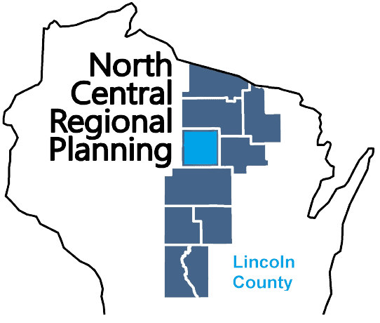
Lincoln County

Lincoln County is a county located in northern Wisconsin. As of the 2020 census, the population was 28,415. The county seat is Merrill. Lincoln County was created in 1881 and is named after Abraham Lincoln, the 16th President of the United States. The county is known for its many lakes, forests, and outdoor recreational opportunities, including the Lincoln County Forest, the Wisconsin River and the Ice Age Trail. The county is mostly rural with paper mills and manufacturing being the main industries. The county has several small towns and communities, including Tomahawk, Merrill, and Gleason. The county is also known for its hunting, fishing, and snowmobiling.

TitleDate
EMSI Reports – Economy OverviewJuly 17, 2024
Lincoln County Broadband PlanFebruary 20, 2024
Lincoln County Economic Profile 2024January 22, 2024
Lincoln County All Hazards Mitigation Plan Update 2023November 14, 2023
City of Merrill Outdoor Recreation Plan 2023-2027October 1, 2022
City of Tomahawk Bicycle and Pedestrian Plan 2022July 1, 2022
Lincoln County Economic Profile 2022June 1, 2022
Town of Russell Road Surface Management Plan 2022-2026January 1, 2022
Grow North Region Housing Study – 2021December 29, 2021
Lincoln County Outdoor Recreation Plan 2022-2026August 1, 2021
Merrill Safe Routes To SchoolJanuary 13, 2021
City of Tomahawk Outdoor Recreation Plan 2020-2024September 1, 2019
Town of Harding, Wisconsin Road Surface Management Plan 2019 – 2023December 1, 2018
Lincoln County Locally Developed, Coordinated Public Transit-Human Service Transportation Plan 2019-2023August 31, 2018
Lincoln County All Hazards Mitigation Plan Update 2017December 19, 2017
City of Tomahawk Comprehensive Plan 2017October 1, 2017
City of Merrill Outdoor Recreation Plan 2018-2022September 1, 2017
City of Merrill Comprehensive Plan 2017March 1, 2017
Lincoln County Land and Water Resource Management Plan 2017-2026November 1, 2016
Lincoln County Farmland Preservation Plan 2016November 1, 2016
Lincoln County Outdoor Recreation Plan 2017-2021September 1, 2016
City of Merrill Bicycle and Pedestrian Plan 2015August 1, 2015
Lincoln County Comprehensive Plan 2012-2021January 1, 2015
STH 64/Pine Ridge Avenue Access Safety Study 2013August 27, 2014
City of Tomahawk, Road Surface Management Plan – 2014January 1, 2014
Lincoln County Locally Developed, Coordinated Public Transit-Human Service Transportation Plan 2014-2018August 21, 2013
City of Merrill Outdoor Recreation Plan 2013-2018February 1, 2013
Town of Harding, Road Surface Management Plan 2013January 1, 2013
City of Tomahawk Traffic Count ReportSeptember 20, 2012
Lincoln County All Hazards Mitigation Plan Update 2012February 21, 2012
Town of Tomahawk, Road Surface Management Plan – 2012February 1, 2012
Lincoln County Outdoor Recreation Plan 2012-2016December 1, 2011

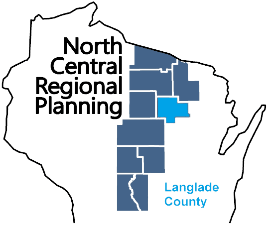
Langlade County

Langlade County is a county located in northern Wisconsin. As of the 2020 census, the population was 19,491. The county seat is Antigo. Langlade County was created in 1879 and is named after Charles Langlade, a prominent fur trader and early settler in Wisconsin. The county is known for its many lakes, forests and outdoor recreational opportunities, including the Langlade County Forest, the Wolf River and the Ice Age Trail. The county is mostly rural with logging and paper mills as major industries. The county has several small towns and communities, including White Lake, Elcho, and Summit Lake. The county is also known for its hunting, fishing, and snowmobiling.

TitleDate
Langlade County Broadband PlanAugust 5, 2024
EMSI Reports – Economy OverviewJuly 17, 2024
Langlade County Economic Profile 2024January 22, 2024
Town of Rolling Comprehensive Plan 2023October 10, 2023
Langlade County Economic Profile 2022June 1, 2022
Grow North Region Housing Study – 2021December 29, 2021
Langlade County Outdoor Recreation Plan 2022-2026September 1, 2021
Langlade County All Hazards Mitigation Plan Update 2020July 21, 2020
Elcho Safe Routes to School PlanJuly 1, 2020
White Lake Safe Routes to School PlanJune 1, 2020
Town of Polar Comprehensive Plan 2019October 17, 2019
Town of Antigo Comprehensive Plan 2019September 1, 2019
Langlade County Land and Water Resource Management 2020-2029July 19, 2019
Langlade County Bicycle and Pedestrian Plan 2019May 21, 2019
Langlade County Comprehensive Plan 2019February 10, 2019
Langlade County Scout Camp Concept Plan – 2019January 1, 2019
Langlade County Locally Developed, Coordinated Public Transit-Human Service Transportation Plan 2019-2023August 31, 2018
City of Antigo Comprehensive Plan 2018August 1, 2018
Langlade County Outdoor Recreation Plan 2017-2021December 1, 2016
Village of White Lake Comprehensive Plan 2017September 26, 2016
Langlade County Farmland Preservation Plan 2014December 1, 2014
Langlade County Land and Water Resource Management 2015-2019November 1, 2014
Northwoods NiiJii Enterprise Community, Inc. Comprehensive Strategic Plan – 2014January 1, 2014
Langlade County, Ice Age National Scenic Trail – 2014January 1, 2014
Langlade County All Hazards Mitigation Plan Update 2013October 22, 2013
Langlade County Locally Developed, Coordinated Public Transit-Human Service Transportation Plan 2014-2018July 25, 2013
Langlade County Outdoor Recreation Plan 2012-2016January 1, 2012
Town of Rolling Traffic Count ReportSeptember 10, 2010
Town of Ainsworth Traffic Count ReportJuly 6, 2010
Antigo Safe Routes to School Plan – 2010-2015June 1, 2010

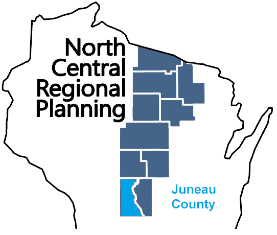
Juneau County

Juneau County is a county located in central Wisconsin. As of the 2020 census, the population was 26,718. The county seat is Mauston. Juneau County was created in 1857 and is named after Solomon Juneau, one of the founders of Milwaukee. The county is known for its rolling hills and valleys, as well as the Lemonweir and Wisconsin rivers. The county is home to the Castle Rock Lake, which is a popular spot for boating and fishing. Agriculture is the main industry in Juneau County, with dairy farming being particularly prevalent. Additionally, the county is home to several small communities and towns, including New Lisbon, Elroy and Necedah.

TitleDate
Juneau County All Hazards Mitigation Plan Update 2024July 23, 2024
EMSI Reports – Economy OverviewJuly 17, 2024
Village of Necedah Comprehensive Plan 2024March 15, 2024
Juneau County Economic Profile 2022January 22, 2024
Juneau County Housing Assessment 2023September 14, 2023
Town of Clearfield Comprehensive Plan 2022May 1, 2022
Village of Camp Douglas Comprehensive Plan 2022April 13, 2022
Juneau County Economic Profile 2024January 1, 2022
Juneau County Outdoor Recreation Plan 2022-2026October 1, 2021
City of Elroy Comprehensive Plan 2021September 14, 2021
Town of Armenia Comprehensive Plan 2021April 14, 2021
City of New Lisbon Comprehensive Plan 2020October 19, 2020
Mauston Safe Routes to School PlanApril 1, 2020
Juneau County Bicycle and Pedestrian Plan 2019April 1, 2019
Human Services Transportation Needs AssessmentMarch 31, 2019
Adams-Juneau Flood Resiliency StudyDecember 1, 2018
Juneau County Locally Developed, Coordinated Public Transit-Human Service Transportation Plan 2019-2023August 20, 2018
Town of Cutler Comprehensive Plan 2018August 1, 2018
Juneau County Housing StudyFebruary 20, 2018
Juneau County All Hazards Mitigation Plan Update 2018January 23, 2018
Town of Lemonweir Comprehensive Plan 2017September 1, 2017
Town of Germantown Comprehensive Plan 2017May 1, 2017
Juneau County Outdoor Recreation Plan 2017-2021February 1, 2017
City of Mauston Outdoor Recreation Plan 2017-2021January 1, 2017
Town of Germantown, Wisconsin Road Surface Management Plan 2017January 1, 2016
Village of Necedah Comprehensive Plan 2015October 1, 2015
Juneau County Locally Developed, Coordinated Public Transit-Human Service Transportation Plan 2014-2018August 22, 2013
Juneau County Outdoor Recreation Plan 2012-2017January 1, 2012
City of Mauston Outdoor Recreation Plan 2012-2016January 1, 2012
Volk Field Hardwood Range Joint Land Use Study – 2011December 1, 2011
Northeast Juneau County Community Wildfire Protection Plan 2010April 1, 2010
City of New Lisbon Comprehensive Plan 2009December 1, 2009
Town of New Plymouth Plan 2009November 1, 2009
City of Elroy Comprehensive Plan 2009November 1, 2009
Town of New Lisbon Comprehensive Plan 2009July 1, 2009