Federal transit law requires that any projects selected for funding under the Section 5310 Enhanced Mobility of Seniors and Individuals with Disabilities (formerly titled Elderly and Disabled Capital Assistance Program) must be derived from a “locally developed, coordinated public transit-human services transportation plan”. This requirement was implemented as part of the SAFETEA-LU legislation and the requirement continues under the new transportation legislation, MAP-21 (Moving Ahead for Progress in the 21st Century). The purpose of the coordinated planning process is to have stakeholder involvement in the assessment of elderly and disabled transportation, and to provide strategies and goals to improve those transportation alternatives. These coordinated plans were last completed in 2008 and are due to be updated in 2013.
Lincoln County Locally Developed, Coordinated Public Transit-Human Service Transportation Plan 2014-2018
Federal transit law requires that any projects selected for funding under the Section 5310 Enhanced Mobility of Seniors and Individuals with Disabilities (formerly titled Elderly and Disabled Capital Assistance Program) must be derived from a “locally developed, coordinated public transit-human services transportation plan”. This requirement was implemented as part of the SAFETEA-LU legislation and the requirement continues under the new transportation legislation, MAP-21 (Moving Ahead for Progress in the 21st Century). The purpose of the coordinated planning process is to have stakeholder involvement in the assessment of elderly and disabled transportation, and to provide strategies and goals to improve those transportation alternatives. These coordinated plans were last completed in 2008 and are due to be updated in 2013.
Town of Cassian Traffic Count Report – 2013
The Town of Cassian requested traffic counting services from the North Central Wisconsin Regional Planning Commission for three locations within the Town.
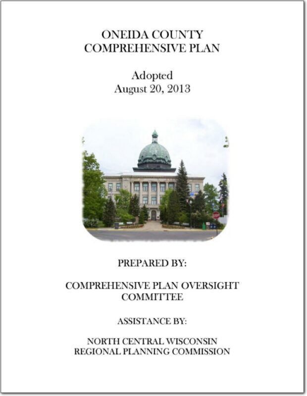
Oneida County Comprehensive Plan 2013
This is the first of nine elements that comprise the Oneida County Comprehensive Plan. The plan provides detailed information on the county and also includes all twenty towns and the City of Rhinelander. Oneida County is located in northeastern Wisconsin and is bounded on the north by Vilas County, on the east by Forest County, on the south by Lincoln and Langlade counties, and on the west by Price County. The county is a predominantly rural area with a large proportion of its land in forests, wetlands, and agriculture. Residents and visitors from both near and far utilize its more than 1,100 lakes and expansive natural areas for recreational purposes. The City of Rhinelander is the county seat and largest community in the county with a population of about 8,200. See the planning context map.
Forest, Oneida, Vilas County Locally Developed, Coordinated Public Transit-Human Service Transportation Plan 2014-2018
Federal transit law requires that any projects selected for funding under the Section 5310 Enhanced Mobility of Seniors and Individuals with Disabilities (formerly titled Elderly and Disabled Capital Assistance Program) must be derived from a “locally developed, coordinated public transit-human services transportation plan”. This requirement was implemented as part of the SAFETEA-LU legislation and the requirement continues under the new transportation legislation, MAP-21 (Moving Ahead for Progress in the 21st Century). The purpose of the coordinated planning process is to have stakeholder involvement in the assessment of elderly and disabled transportation, and to provide strategies and goals to improve those transportation alternatives. These coordinated plans were last completed in 2008 and are due to be updated in 2013.
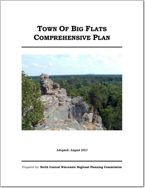
Town of Big Flats Comprehensive Plan 2013
The Town of Big Flats is an eight-mile by six-mile town with 48 sections, located in thev north-central part of Adams County, Wisconsin. The Town of Rome to the north, the Town of Colburn to the east, the Town of Monroe to the west, and the Towns of Strongs Prairie and Preston to the south bound the town. It is one of the seventeen towns in the county. Over the years the town has been dominated by swampland conifers and lowland hardwood forest types, and some agricultural uses. Scattered residential development also has been locating in the town.
Langlade County Locally Developed, Coordinated Public Transit-Human Service Transportation Plan 2014-2018
Federal transit law requires that any projects selected for funding under the Section 5310 Enhanced Mobility of Seniors and Individuals with Disabilities (formerly titled Elderly and Disabled Capital Assistance Program) must be derived from a “locally developed, coordinated public transit-human services transportation plan”. This requirement was implemented as part of the SAFETEA-LU legislation and the requirement continues under the new transportation legislation, MAP-21 (Moving Ahead for Progress in the 21st Century). The purpose of the coordinated planning process is to have stakeholder involvement in the assessment of elderly and disabled transportation, and to provide strategies and goals to improve those transportation alternatives. These coordinated plans were last completed in 2008 and are due to be updated in 2013.
Portage County Locally Developed, Coordinated Public Transit-Human Service Transportation Plan 2014-2018
Federal transit law requires that any projects selected for funding under the Section 5310 Enhanced Mobility of Seniors and Individuals with Disabilities (formerly titled Elderly and Disabled Capital Assistance Program) must be derived from a “locally developed, coordinated public transit-human services transportation plan”. This requirement was implemented as part of the SAFETEA-LU legislation and the requirement continues under the new transportation legislation, FAST Act (Fixing America’s Surface Transportation). The purpose of the coordinated planning process is to have stakeholder involvement in the assessment of elderly and disabled transportation, and to provide strategies and goals to improve those transportation alternatives. These coordinated plans were last completed in 2008 and are due to be updated
for 2013.
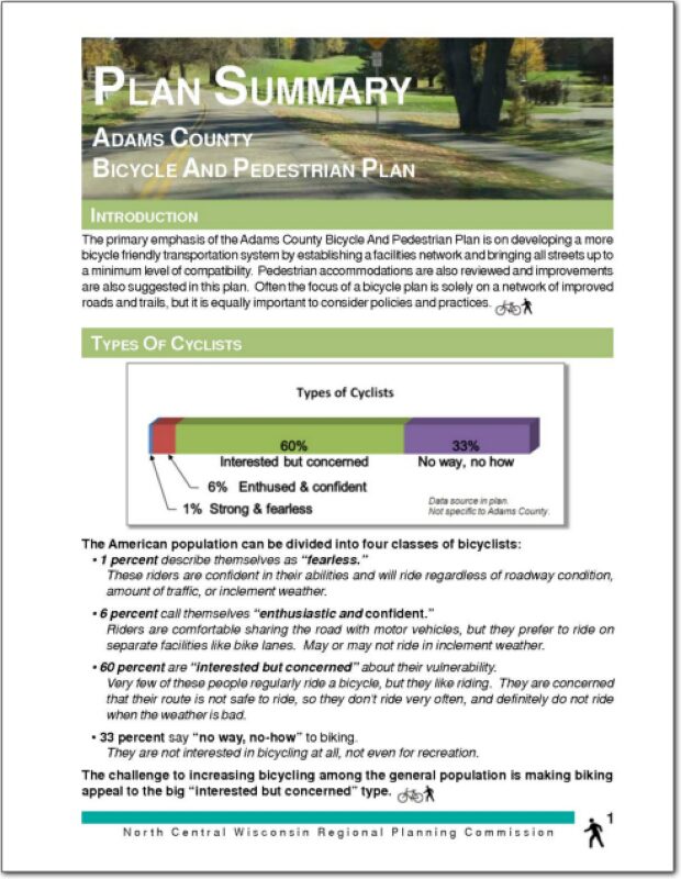
Adams County Bicycle & Pedestrian Plan Summary
The primary emphasis of the Adams County Bicycle And Pedestrian Plan is on developing a more bicycle friendly transportation system by establishing a facilities network and bringing all streets up to a minimum level of compatibility. Pedestrian accommodations are also reviewed and improvements are also suggested in this plan. Often the focus of a bicycle plan is solely on a network of improved roads and trails, but it is equally important to consider policies and practices.
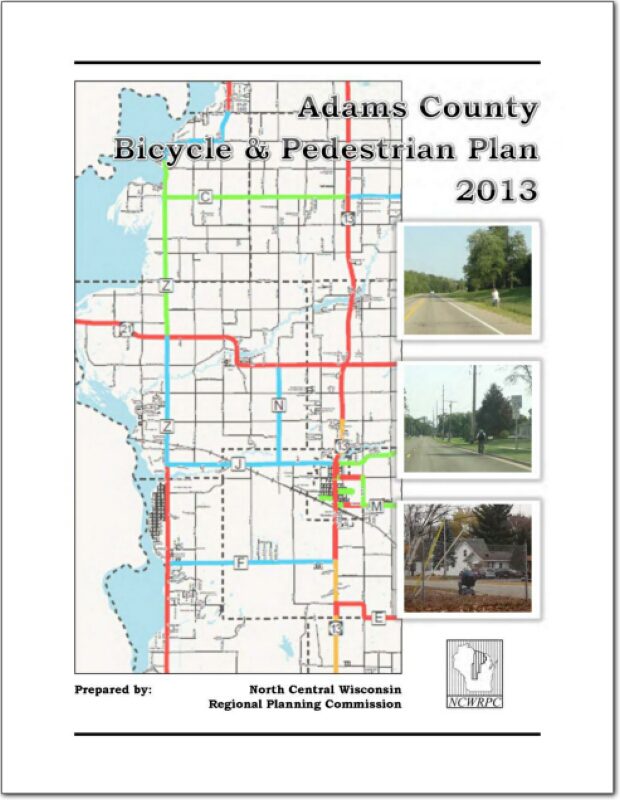
Adams County Bicycle & Pedestrian Plan – 2013
The primary emphasis of this plan is on developing a more bicycle friendly transportation system by establishing a facilities network and bringing all streets up to a minimum level of compatibility. Pedestrian accommodations are also reviewed and improvements are also suggested in this plan. Often the focus of a bicycle plan is solely on a network of improved roads and trails, but it is equally important to consider policies and practices. See Chapter 4 to read the vision statement and goals of this plan.